
Westport Neighbors by Public Source
A block lookup works only when each source is used for its own purpose. AxisGIS draws the nearby parcel set. Vision provides a separate current card for each parcel. Deeds and maps explain lot relationships, while permits and notices add dated civic context. Voter and organization records are limited access or lead sources, not a complete list of everyone nearby.
| Source | What It Shows About a Block | Access |
|---|---|---|
| AxisGIS parcel map | Parcel shapes, roads, zoning, flood, wetland and boundary layers | Public viewer and parcel click |
| AxisGIS Abutters | Selected parcel and chosen-radius notice set | Town workflow uses 250 or 500 feet |
| Vision cards | Owner, mailing, parcel, value, use and deed pointer | Open one current card per parcel |
| Town maps and deeds | Subdivision, lot, legal description and recorded ownership | Town Clerk and RecordHub |
| Public applications | Permits, notices, dates and public applicants | Current and legacy town modules |
| Voter file | Permitted fields, not all occupants | Certified $300 statewide CSV request |
| Community groups | Public events, officers and civic context | Town list and group sites, no assumed roster |
A property card proves what the assessor currently publishes about a parcel. It does not identify every occupant. A registration entry shows voter status under election rules, not the full household. Preserve those distinctions before describing anyone as one of the current Westport neighbors.
Click a Westport Parcel First
Open the Westport AxisGIS viewer, type the subject address, and choose the correct autocomplete result. Click the parcel box before moving outward. Save its parcel ID, map context, and available layers, then follow the Vision link for the field card. This cross-key set keeps a nearby lot from being confused with the subject property.
AxisGIS is informational. Parcel lines, aerials, zoning, wetlands, flood information, permit layers, and public-works layers answer different questions. Record which layer supplied each fact and the date checked. The map is best at defining the block around one address, while the Westport street directory handles an entire named street.
Map Westport's Adjacent Owners
The town's abutter workflow makes the radius explicit. Planning and zoning instructions use 250 feet for A or Commercial zones and 500 feet for AA or AAA zones. Use the distance required by the notice or research question rather than accepting a default radius. The resulting parcel set is a notice tool, not a list of occupants.
- Select the subject address in AxisGIS and confirm the parcel box.
- Choose Abutters and enter the distance required by the applicable notice.
- Save or print the current map and note each returned parcel ID separately.
- Open each linked Vision card and copy situs address, owner, mailing address, PID or MBLU, and deed pointer.
- Check town applications and Town Clerk maps for a shared project, notice, subdivision, or lot boundary.
Do not merge parcels just because they share a road. A mailing address may belong elsewhere, an entity owner does not identify all users of the property, and an abutter radius may cross streets or historic-area labels.
Compare Westport Neighbor Cards
Open the Vision property record for every parcel returned by the map. Keep a row for situs address, recorded owner, mailing address, account, PID or MBLU, use, deed pointer, and card date. The town says its current database is a work in progress, so a dated research log matters.
Matching owner and mailing addresses may support an owner-occupancy inference, but they do not prove every resident. A different mailing address may reflect many ordinary arrangements. Use cautious labels such as recorded owner or mailing contact, and reserve neighbor or occupant for a public source that actually supports it.
Westport Applications Add Block Context
AxisGIS links block geography with Planning and Zoning, Conservation, Building, Fire, and Public Works material. Search public modules by address for dated applications, abutter notices, projects, and hearings. Several parcels appearing in the same subdivision filing or public notice can explain a real civic relationship without implying a private household connection.
Town Clerk maps and deeds remain the authority for subdivision, lot, and legal-description links. Building and permit records show projects, dates, status, and public applicants where released, but an applicant is not necessarily an occupant. When the online route does not return an older item, use the department's legacy archive, meeting minutes, counter, or a Connecticut Freedom of Information Act request.
Westport Voters Are Not Occupants
The Connecticut voter lookup was unstable during research, and an individual lookup is not a block export. The statewide voter file requires a $300 CSV request through the Secretary of the State and a certification of legally permitted use. Month and day of birth, matching identifiers, protected addresses, and safety-program details are restricted.
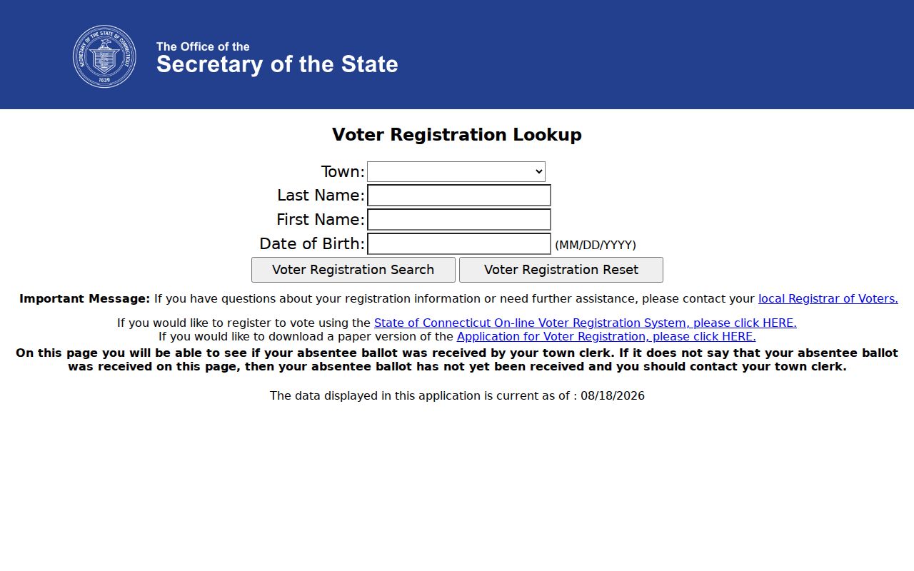
Never infer that every adult at a parcel is registered or that every registrant is a current occupant. Owner, voter, directory occupant, permit applicant, and household member remain separate categories. The registrar counter and Secretary of the State are the fallback routes when the live lookup fails.
Note: Connecticut's Safe at Home program and protected-voter procedures can suppress a real address, so a missing result is not proof of absence.
Westport Neighborhood Names as Clues
Bankside, Green's Farms, Saugatuck, Compo, Coleytown, Taylortown, Old Hill, Long Lots, and Westport Center are confirmed historic area names. They help search old maps, newspapers, directories, and meeting minutes. They are not automatic association boundaries, and they should not be used to assign a household to a private group.
The town's historic districts and properties, including named sites and districts on its published list, add geographic context. Use the Town Clerk map or legal description for a boundary claim. This local naming layer often explains why older records around a modern Westport block use a place name rather than today's street or ZIP label.
Westport Civic Groups, Not Rosters
The town community-organization list is a starting point for public civic context. It includes Neighbors & Newcomers of Westport, the League of Women Voters, the Downtown Association, and other organizations. Research found no complete official neighborhood-association or HOA boundary inventory.
Town community list
Use public group links, events, and contact information as leads. Verify whether a group covers the parcel.
Neighbors & Newcomers
Founded in 1963 for connection, events, and welcome. Its public site does not publish a parcel-level member directory.
Historic districts
Designation supplies geographic and civic context, not a current resident or membership roster.
Public event pages and meeting minutes may name officers or applicants with a date and role. They do not reveal the whole membership. Congregation, block-watch, civic-club, and current alumni rosters were not verified in official public sources.
Official Westport Records Compare Better
Commercial neighbor tools may combine stale or unverified data without showing the custodian or date. Official records are narrower but easier to audit. They tell the reader which office created the fact and what the record actually means.
| Route | Strength | Limit |
|---|---|---|
| AxisGIS and Vision | Current parcel and recorded-owner context | Not a household list |
| Town maps and applications | Dated lot and civic evidence | Applicant may not reside there |
| Commercial category | May gather broad name and address claims | Source, date, accuracy, and lawful use may be unclear |
For each nearby parcel, save the official URL, date checked, field label, and what it proves. That small audit trail is more useful than a broad list of alleged Westport neighbors with no source.
Protect Privacy in Westport Lookup
Occupants absent from a public record remain private. Household members, protected voters, Safe at Home participants, utility customers, delivery records, juvenile or sensitive police material, and sealed court or vital files fall outside an ordinary neighbor lookup. If a parcel has an entity owner, a business filing may identify a registered agent or principal, not all people using the site.
A block note should state what was visible, which custodian supplied it, and when it was checked. It should also state which person categories remain unverified. Do not publish a speculative roster or use missing records to draw conclusions about a household.
Lawful use. Use Westport neighbor records for civic understanding, reconnecting, property curiosity, or personal safety. Never watch, harass, intimidate, or harm another person.